For those who like to walk and explore, Alanya is an ideal place. We have compiled for you some of the routes that you can experience in Alanya.
Alanya Mamadı - Yumru Tepesi – Hıdırellez; the route, which offers a wonderful view of Alanya almost the entire walk, is about 16 kilometers away. The maximum elevation of the route is 1015 meters, and the minimum elevation is 165 meters. The route is at a difficult level according to the level of technical difficulty. It is known that those who walk this route complete the route in about 10 hours.
Çıkrık - Payamağacı – Obaalakilise; the route, which also includes the old migration routes, also allows you to make a trip through history. The distance of the route is about 16 kilometers. Its maximum elevation is 1207 meters and its minimum elevation is 389 meters. The technical difficulty level of the route is medium difficulty. Those who walked this route usually completed the route in 9 hours.
Alanya Hagios Georgios Kilisesi - Hamaxia Antik Kenti - Yat Limanı; the route, accompanied by beautiful landscapes, is about 14 kilometers. The maximum elevation of the route is 734 meters, and the minimum elevation is 10 meters. The technical difficulty level is medium difficulty.
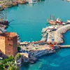
Alanya Kalesi;The route, which includes a walk along the historical walls of the castle, is a good option for those who want to see the Alanya Castle soon. The route is about 9 kilometers. It has a maximum elevation of 419 meters and a minimum elevation of 26 meters.
Information about the routes is taken from the Wikiloc site. More detailed information about the routes and more different routes can be found here.
0 Comments


.webp)

.webp)


